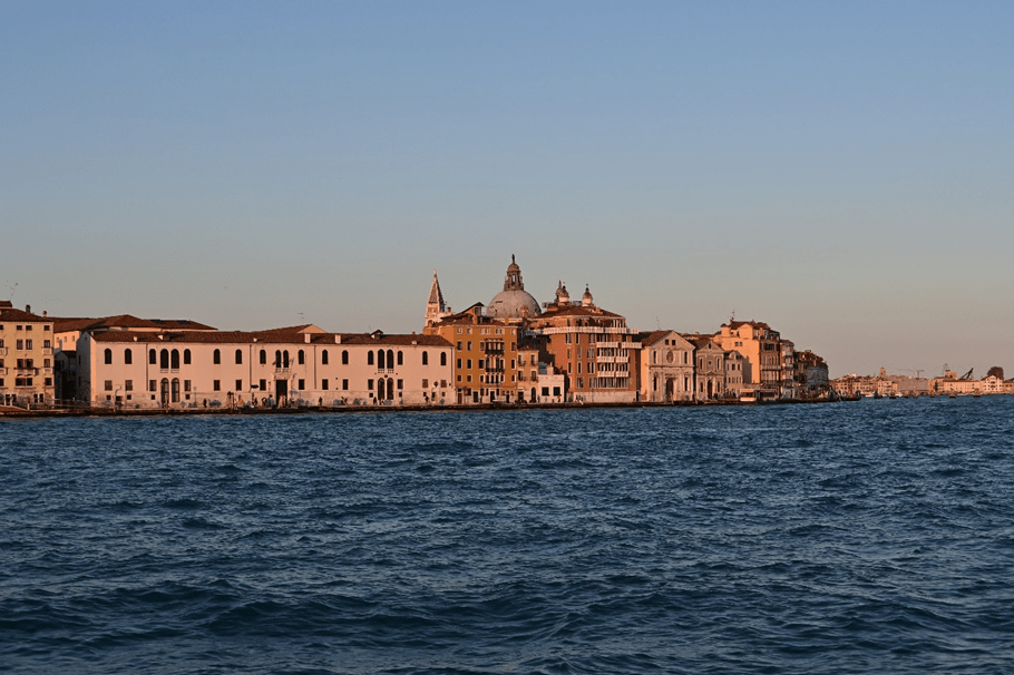
Venice and its lagoon are faced with alarming prospects regarding the rise in sea level. A multidisciplinary study conducted by researchers from the National Institute of Geophysics and Volcanology (Ingv), in collaboration with Italian and foreign bodies, has analyzed the latest climatic projections of the intergovernmental panel on climate change (IPCC) and geodesic data available to estimate the extension of the areas at risk of flooding in the coming decades.
“The investigation was conducted with the aim of providing information on the next evolution of the laying of sea level in the Venice lagoon to understand how this can influence one of the most iconic cities in the world“, He says, Marco Anzidei, the first author of the research of the Ingv.
The research, published in the magazine ‘Remote Sensing‘, assumes critical scenarios for the entire lagoon. Mose, the mobile barriers system designed to protect Venice from high waterscurrently calibrated for a maximum difference in altitude of 3 meters between open sea and lagoon and an average level of the sea of 60 cm in 2100, it could be exceeded by the rise in the marine level towards the end of the century.
The study combined geodesic data (GNSS and SAR), temporal series of sea level (ISPRA and Venice Mare Center) and high resolution topographical data (Co.ri and Mase) to evaluate the impact of the variations of the marine level on the coasts and on the islands of the lagoon until 2150.
“To estimate the effects of the increase in sea level in the Venice lagoon by 2150, the study has adopted a multidisciplinary approach based on different types of data, including the geodesic ones from the goals of Global Navigation Satellite System stations, known as GNSS, the satellite data Synthetic openings Radar – SAR (which together with the GNSS stations allows you to measure the movements of the soil movements With millimetric precision), the time series of sea level collected by the Mareografi network by the Higher Institute for Environmental Protection and Research (ISPRA) and by the Maree forecast and reporting Center of the Municipality of Venice and high resolution topographic data made available by the Co.Ri.la and the Ministry of the Environment and Energy Safety (Mase)“, They explain Marco Anzidei and Cristiano Tolomei, Ingv researchers.
“The results indicate that in the worst case the seaside level of 2150 could increase up to 3.47 meters above the reference of the Punta della Salute Mareographic station, located in the Judecca channel, in the event of extreme high -tide events, similar to those that occurred in 1966 and more recently in 2019. The territory potentially submerged by 2150, in addition, would reach the 139 km², with an extension that could reach 226 km (equal to 64% 64%. of the investigated area) in case of these exceptional high waters. The data show that without further specific interventions Venice will be more exposed to flood phenomena, with a significant impact on the population and the historical heritage“, Add Tommaso Alberti and Daniele Trippanera, Ingv researchers. The analysis made it possible to project the expected sea levels and to process detailed maps of the possible flood scenarios for 2050, 2100 and 2150, in the absence of further protection systems. In the worst case, the sea level in 2150 could increase up to 3.47 meters above the reference of the Punta della Salute Mareographic station, in conjunction with extreme high -tide events similar to those of 1966 and 2019. The territory potentially submerged by 2150 would reach 139 km², With an extension that could reach 226 km² in case of exceptional high waters.
“The scenarios outlined suggest that it is necessary to undertake as soon as possible of updates to territorial planning and risk plans by political decision makers and local authorities, with concrete actions to protect Venice and its lagoon. Only through responsible and conscious management, will it be possible to preserve the city, its population and a cultural heritage unique in the world from the consequences of the laying of sea level expected in the coming decades“concludes Marco Anzidei.
The study highlights how the increase in sea level in the lagoon is a historical phenomenon, amplified today by the effects of climate change and the continuous subsidy of the soil, which in some areas reaches values up to 7 mm per year. The lowest areas of the lagoon are therefore most exposed to the risk of flooding, with critical implications for coastal infrastructures and economic activities.
